Hinamatsuri material set

Kanto and Kansai Sakuramochi

Seal-style surname icons - 201st to 240th

Municipal map _ Ibaraki prefecture _ deformation-01

Municipality map_Gunma prefecture_Deformation-03

Municipal map _ Ibaraki prefecture _ deformation-04

Municipal map _ Ibaraki prefecture _ deformation-05

Municipal map _ Ibaraki prefecture _ deformation-03

Municipal map _ Ibaraki prefecture _ deformation-02

Map of towns and villages_Gunma Prefecture_Deformation-02

Municipality map_Gunma prefecture_Deformation-09

Hinamatsuri simple illustration set

akita monochrome

Japan map ~ Regional division ~ Standard simple

Map of Japan Map of Japan Regional map

Kanto Region Map

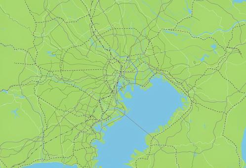
A simple road map of the capital region

Map of Japan

Map of Japan layered by area

Dolls and Emperor for Hinamatsuri 01

Kanto region (including prefectural capitals)

White background map Japan nationwide 【Can be divided into prefectural parts】

Map of Japan (color-coded by region)

Map of Japan

Other 033

Japan map dot illustration material

Map of Kanto_Vivid color version

Ozoni

Ozoni Kanto style

Deformed illustrations of Japanese maps Prefectures

Kanto region

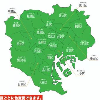
Tokyo 23 wards map

Tokyo 23 wards map
![Japan map nationwide version [possible to divide prefecture parts], JPG, PNG and AI Japan map nationwide version [possible to divide prefecture parts], , JPG, PNG and AI](https://thumb.ac-illust.com/5f/5fd1218bd0d011030c9284a134b7469f_t.jpeg)
Japan map nationwide version [possible to divide prefecture parts]

Tokyo 23 Wards

Kanto region (including remote islands)

Kanto region
![Tatami pattern [Edo-ma], JPG and AI Tatami pattern [Edo-ma], , JPG and AI](https://thumb.ac-illust.com/47/47f9aacfb2af57570555bd0d38115161_t.jpeg)
Tatami pattern [Edo-ma]

Map of Japan

Illustration of the Tohoku Six Major Festivals

A simple road map of Ibaraki Prefecture

Akita Rod Lantern Festival

Map of Japan

熊本県イラスト

Map of Japan (47 prefectures, no region names)

Map of Japan (47 prefectures, no region names) 02

Simple Kanto region

Map of Japan (47 prefectures, by area)

A simple road map of Gunma Prefecture

Chiba

Other 032

Kanto region blank map that can be disassembled

Prefecture silhouette_Kanto region

Ozoni 2

Other 030

A simple green road map of the capital region

Opening the sake barrel icon 2

Ozoni (1)

Kanagawa 5

Kanagawa 4

Kanagawa Prefecture 3

Kanagawa Prefecture 1

Kanagawa Prefecture 2

Tokyo 2

Tokyo 1

Tokyo 3

Kanto region map illustration

茨城県

Expanded dot map of Tokyo

●の日本地図_地方分け_2

Ozoni and snake

Kanto region

Ozoni (Kanto style)

秋田県の観光地、名所、文化、素材


Map of Gunma Prefecture Entering the name of the municipality

A simple road map of Tochigi Prefecture
![Map nationwide version Japan [parts can be divided by prefecture], JPG, PNG and AI Map nationwide version Japan [parts can be divided by prefecture], , JPG, PNG and AI](https://thumb.ac-illust.com/32/32c5480ff40e60efe69606cd7952a536_t.jpeg)
Map nationwide version Japan [parts can be divided by prefecture]

A simple road map of Gunma Prefecture

Chiba Prefecture 2

Chiba Prefecture 5

Chiba Prefecture 3

Chiba Prefecture 4

Chiba Prefecture 1

Map of Tochigi Prefecture with city name

Map of Chiba Prefecture Entering the name of the municipality

Saitama

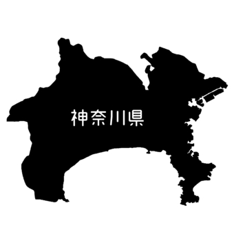
神奈川県

Kanto Region Map

Tokyo 5

Tokyo 4

日本地図 県境付き

Ozoni and red rice (half moon tray)

Saitama 2

Saitama Prefecture 3

Saitama Prefecture 5

Saitama Prefecture 4

Saitama Prefecture 1

Illustration of the shape of Chiba_outline

Gunma Prefecture 1
1220 Darmowy clipart o .
Potrzebujesz grafiki wektorowej? Znajdź najlepsze zdjęcia o .
Wszystkie grafiki wektorowej są bezpłatne, nawet w przypadku komercyjnych projektów. Nie wymaga żadnego atrybutu.

 © 2011 - 2025 ACworks Co.,Ltd. All rights reserved.


